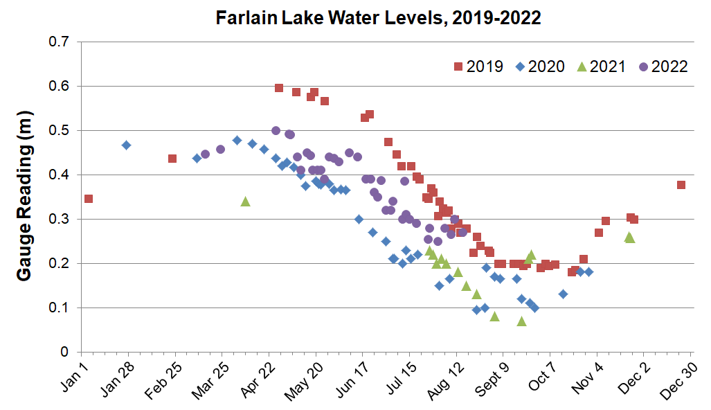
Water level fluctuations are a natural part of the functioning of a lake, and can be caused by climate related factors such as rainfall, and timing of winter rains and spring melt. Levels in the inland lakes in the watershed are only routinely monitored when SSEA completes a water quality survey (approx. 5 year cycle). Having more frequent measurements of inland lake water levels is critical to understanding how climate variables influence lake levels.
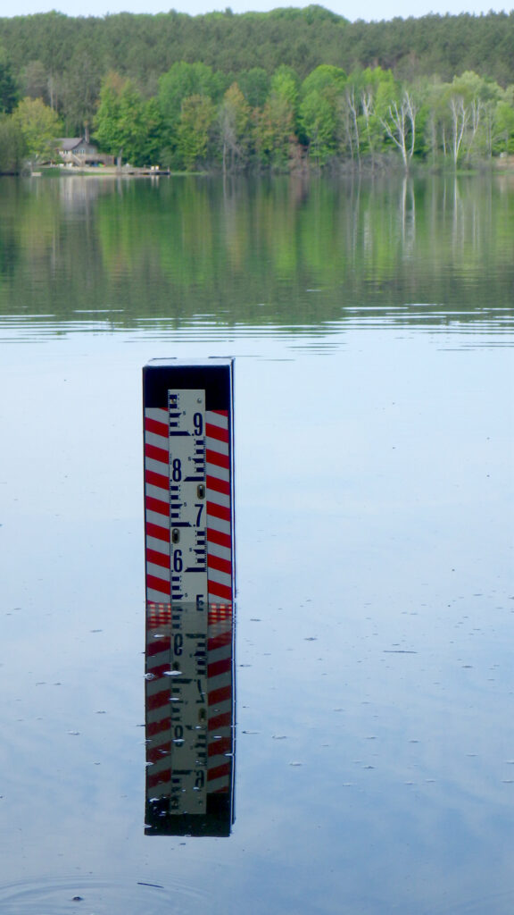
At this time, the Water Level Watch program is only available for Farlain Lake. Through a partnership between SSEA, Township of Tiny and the Farlain Lake Community Association (FLCA), a water level gauge (below) was installed at the public boat launch on Andrew Dr in June 2019. The gauge is located just offshore of the
southern boundary of the municipal park.
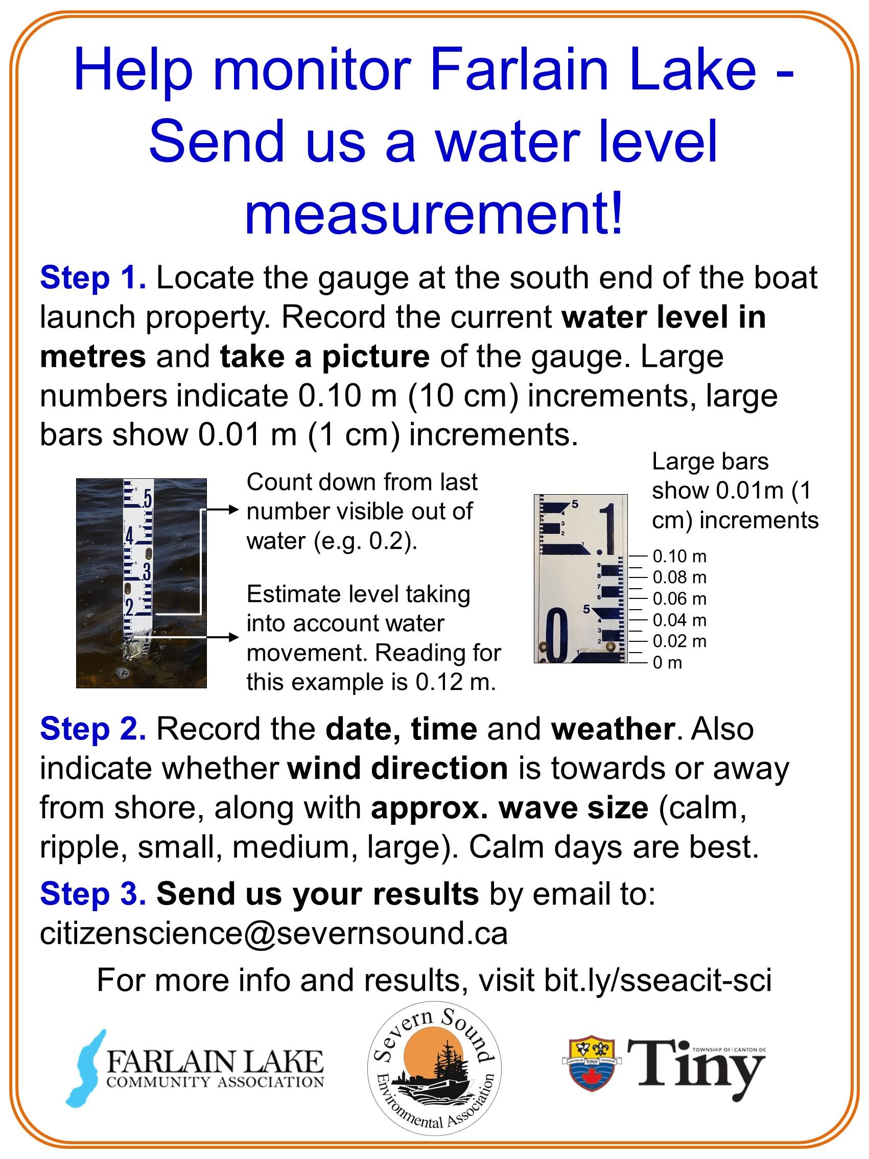
Volunteers can submit water level readings and photos of the gauge (to help verify observations) by email to
citizenscience@severnsound.ca with “Farlain Lake water levels” in the title. Volunteers are also asked to record weather conditions (sun/cloud), whether winds are onshore or offshore, and give an estimate of wave height (calm, ripple, small, medium, large). It’s best not to record water levels when waves are larger than approx. 15 cm (6 in).