Weather Stations
Weather Station Details
Near-real-time, wind, rain, barometric pressure, temperature and humidity are recorded through the weather stations wireless, solar powered sensors. Collected data is then transmitted to a server at Weather INnovations in Chatham, Ontario where it is stored, quality checked and made available by remote access to the cost sharing partners.
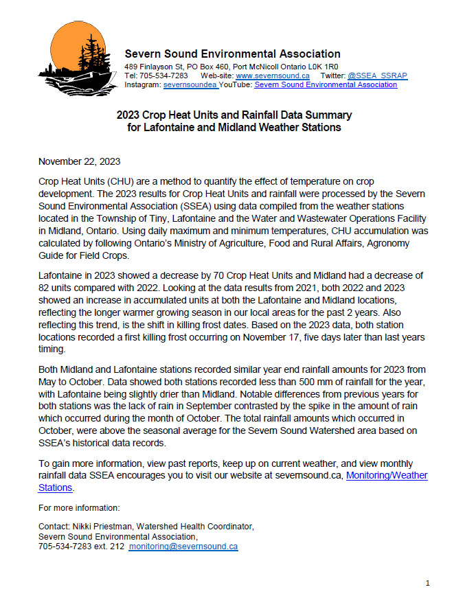
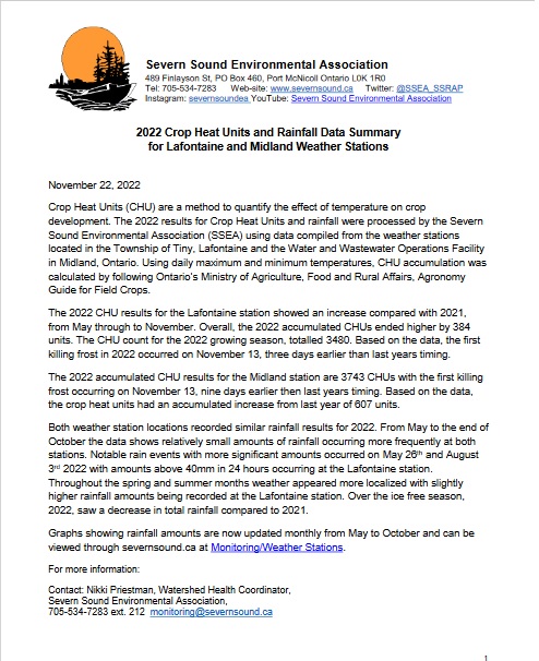
Accumulated Crop Heat Units (CHUs) is provided along with the other weather parameters on our web site. CHUs are a measure of the growth and maturing potential of warm season crops such as corn and soybeans and can assist farmers with crop production.
SSEA uses the data collected at our local weather stations to augment our network of temperature and rain loggers located throughout the Severn Sound watershed leading to improved project, program and service delivery. Collecting weather data with this equipment provides the SSEA with:
- The ability to analyze local climate trends, used for climate adaptation planning and risk analysis, and providing a scientific basis to support municipal decision making
- Additional background information for monitoring projects in the Severn Sound and Tiny Coastal Area watersheds, putting monitoring results into context (e.g water quality and quantity, inland lake levels, trends in algae growth)
- Assistance with calibration of other SSEA weather monitoring equipment
- A level of redundancy helping to prevent data loss.
The SSEA Weather Station information shown above includes the following parameters:
- Time and Date of the most recent data (within the nearest hour)
- Air Temperature (degrees Celsius)
- High and Low Air Temperature (degrees Celsius and time)
- Wind Speed and direction (km/hour and cardinal direction with basic divisions)
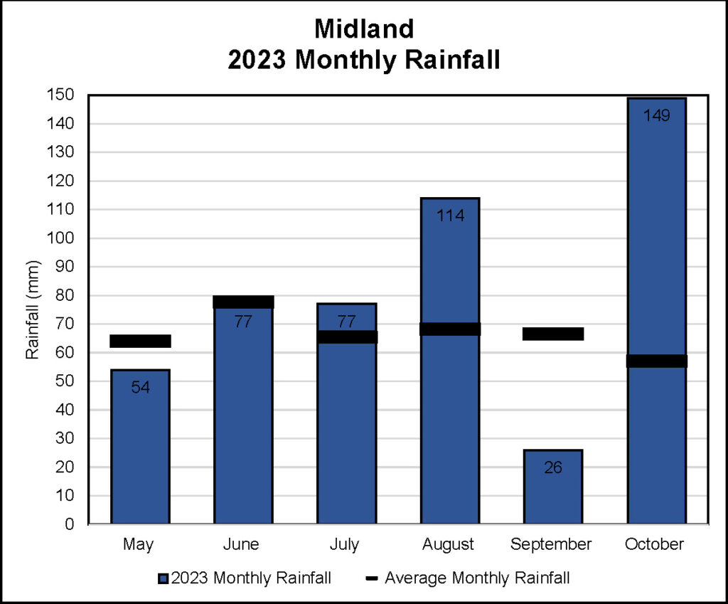
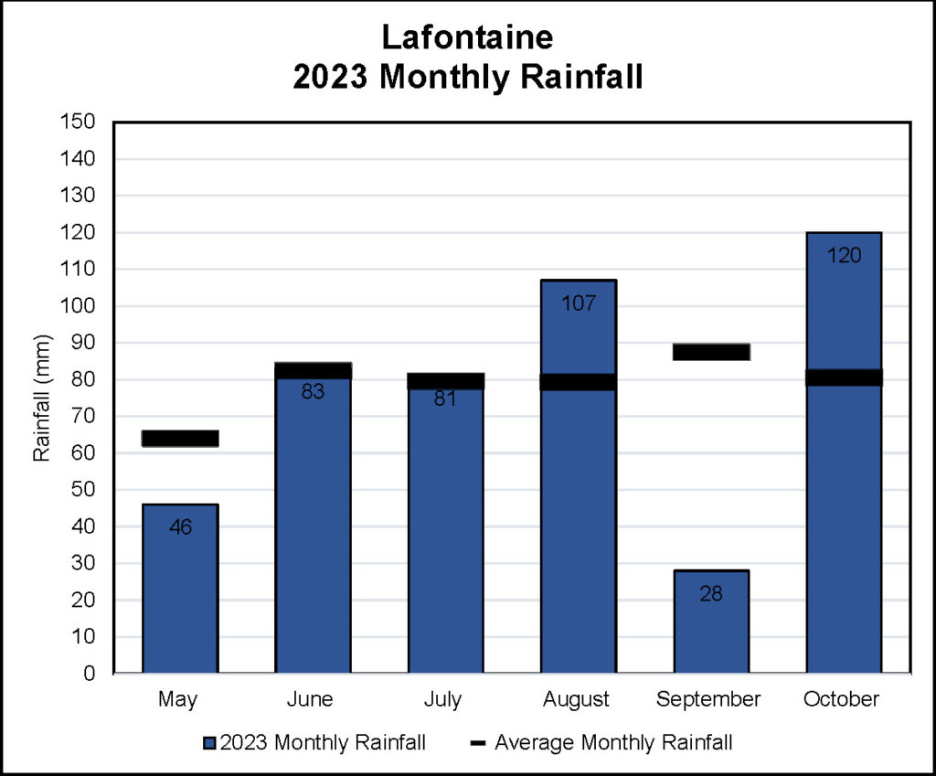
- Daily Rain (millimeters)
- Seasonal Rain Accumulated (millimeters) – April to November
- Barometric Pressure (kiloPascals)
- Accumulated Crop Heat Units recorded from May to November
The data is available to the public through SSEA Reporting. Current conditions data is made available on www.severnsound.ca.
Notes:
- Winter Precipitation (Rain, Ice and Snow) is not measured.
Disclaimer: Information viewed on severnsound.ca is provided as a public service on an “as is” basis. SSEA does not guarantee that the information is current or accurate and accepts no liability for damages caused by the use of this information. Any party relying on this information does so at their own risk.
our local weather stations
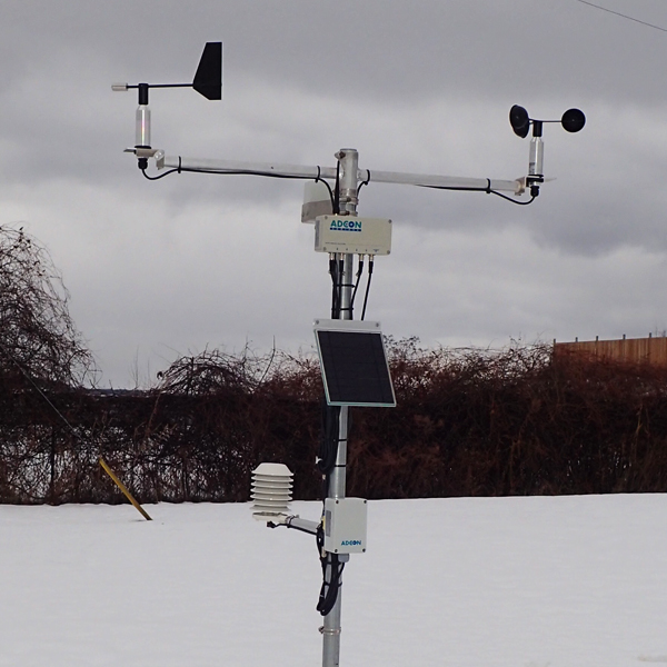
Midland Weather
Station
SSEA partnered with the Towns of Midland and Penetanguishene and the Township of Tay to install an ADCON weather station in December of 2020 at the Midland Water and Wastewater Operations Facility.
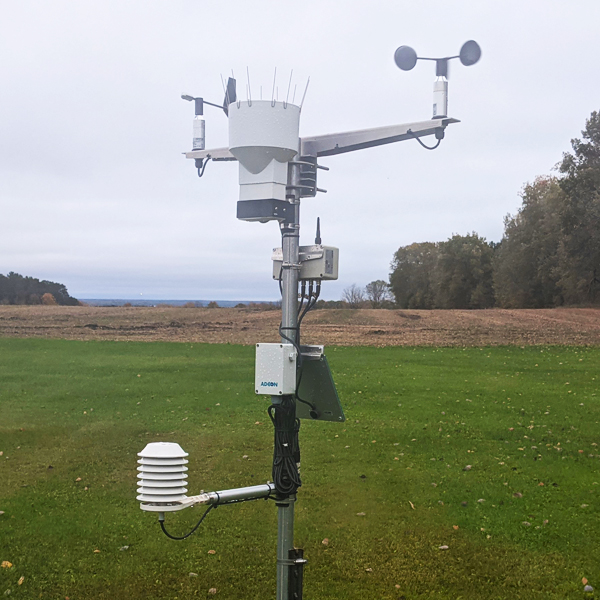
Lafontaine, Tiny Township Weather Station
In October 2021, SSEA’s Healthy Soils(Healthy Watersheds
program) partnered with Township of Tiny to install an ADCON weather station in Lafontaine. Funding for the equipment was provided by the Township and Ontario’s Great Lake Local Action Fund with maintenance support from SSEA.
